CSUNav:
A project under the Supervision of Dr. Chengwei Lei
By Heriberto Jimenez, Zachary Kaiser, Guangjin L Cameron McDaniel

About CSUNav
CSUNav was designed with the idea of helping new and old visitors alike to navigate CSUB. Despite significant advancements in mapping technology, many new college students and campus visitors still get lost on university grounds. Currently, the only means of navigation available to students are obsolete paper maps. In addition, online routing software does not route to specific buildings or classrooms. There is no readily-available method of quickly locating the numerous buildings, classrooms, and offices that make up a university campus. This project aims to resolve this issue and provide university visitors with real-time navigation from their mobile devices.
Below is a short video of how it works.
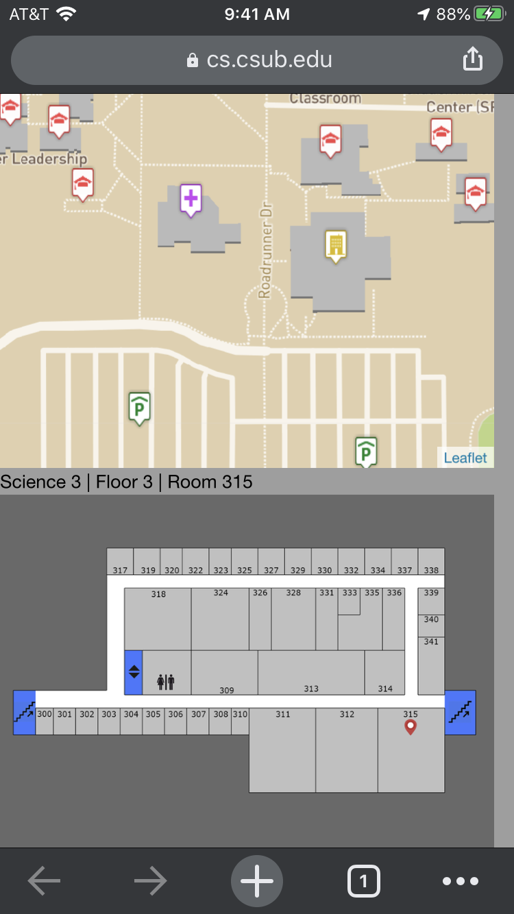
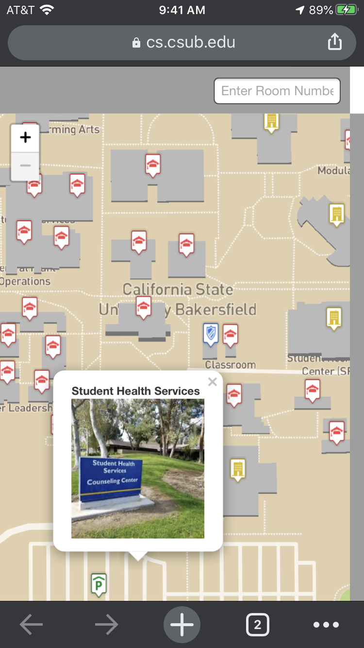
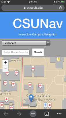
Screenshots of the mobile app
Link
This is the link to the current working version of the application:
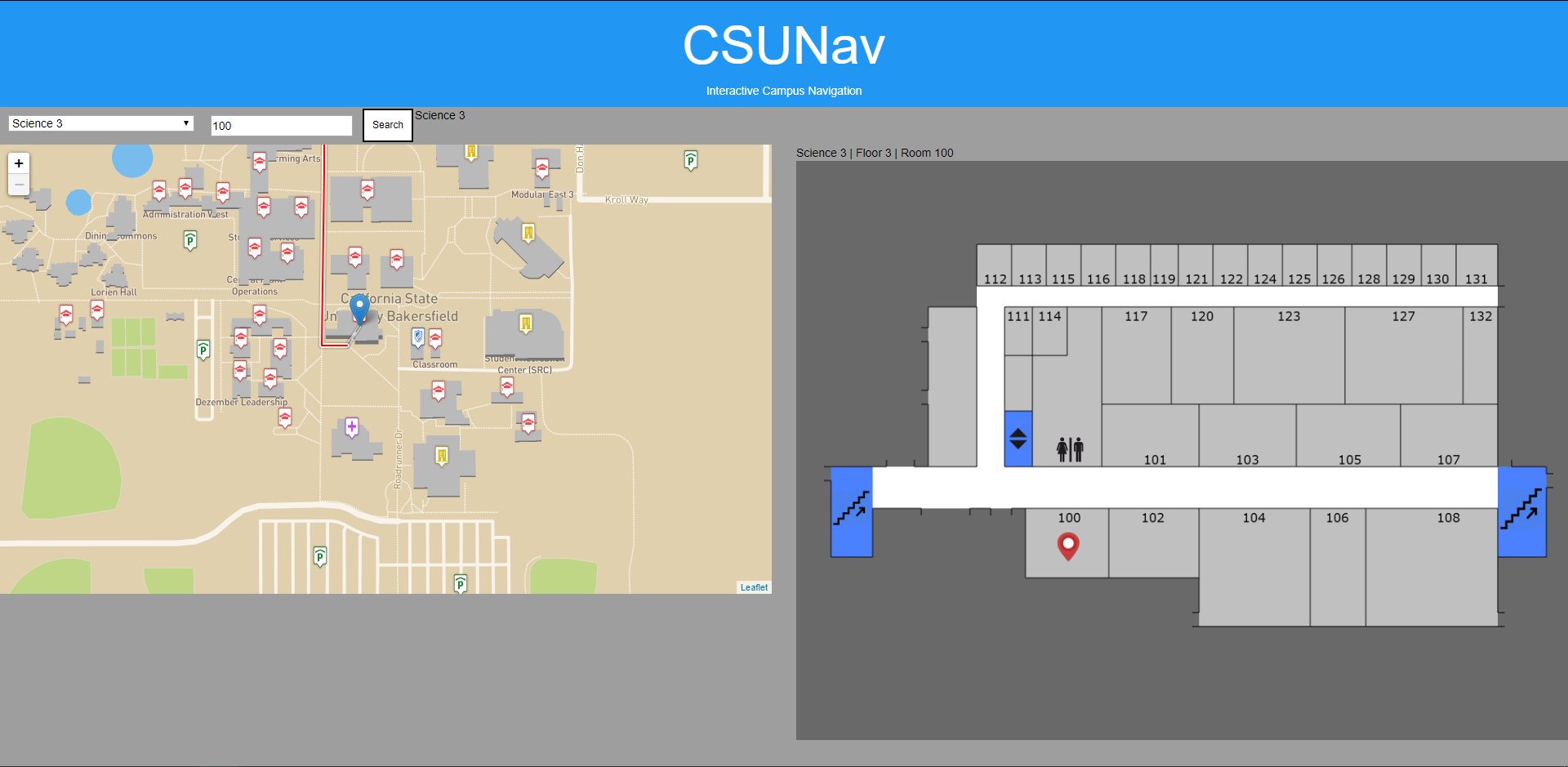
CSUNavNOTE: This works best when using a mobile device and on campus, as our boundaries have been set within the campus of CSUB. Also, our efforts were focused primarily on the Science buildings, so Science III and Science I are the only indoor maps we made.